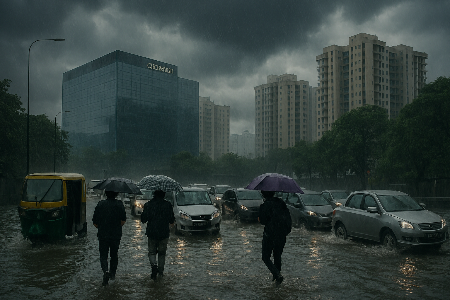
Bangalore Weather Update: Heavy Rains Continue for 3 More Days, City Braces for Traffic & Flood Woes

Bangalore is set to receive heavy rain over the next three days, leading to traffic chaos and waterlogging. Here’s what residents need to know about the latest weather patterns.
Table of Contents
Published: August 05, 2025
Last Updated: August 05, 2025
Category: Weather & Urban Affairs
Overview: Bangalore Monsoon Conditions and Official Weather Alert
The India Meteorological Department (IMD) issued weather forecasts for Bangalore during August 2025 predicting increased precipitation and storm activity across the metropolitan region. The forecasts indicated heavy to very heavy rainfall expected through August 8, 2025, affecting a population of approximately 12 million residents across Greater Bangalore.
The meteorological alert reflects annual monsoon system patterns affecting South India during the southwest monsoon season. Bangalore’s geographic location on the Deccan Plateau creates specific vulnerabilities to precipitation during this period. Understanding the official forecast, potential infrastructure impacts, and institutional responses provides residents and organizations information needed for effective planning and preparation.
Meteorological Framework and Weather System Analysis
Atmospheric System Development
The IMD’s weather monitoring systems documented atmospheric conditions developing over the Bay of Bengal that influenced Bangalore’s forecast through August 2025. An upper-air cyclonic circulation originating from the Bay of Bengal system created conditions for organized precipitation patterns affecting the Deccan Plateau region.
The meteorological analysis identified moisture-laden wind patterns transporting moisture from oceanic sources toward the Bangalore region. The interaction of these wind patterns with local topographic features created the predicted precipitation conditions. IMD monitoring included Doppler radar observations, satellite imagery analysis, and atmospheric model simulations.
Documented Meteorological Characteristics:
| Parameter | Forecast Range | Context |
|---|---|---|
| Daily Rainfall | 64-115 mm | Heavy to very heavy classification |
| Wind Speed | 30-40 km/h | Sustained monsoon winds |
| Wind Gusts | Up to 55 km/h | Storm-associated wind variations |
| Humidity Levels | 85-95% | High moisture content |
| Duration | August 5-8, 2025 | Peak intensity period |
The meteorological system represented typical monsoon season conditions rather than extreme weather phenomena. Rainfall intensities within the forecasted range align with historical patterns documented during southwest monsoon season across southern India. The concentrated precipitation period reflected typical monsoon weather system characteristics.
Precipitation Forecast Details
The IMD’s forecast specified daily rainfall ranging from 64 to 115 millimeters during the August 5-8 period. This classification places forecast precipitation within the “heavy to very heavy” category established by meteorological agencies. The forecast incorporated probability assessments and uncertainty ranges reflecting meteorological modeling limitations.
Hourly precipitation rates were predicted to vary throughout the day, with maximum intensity occurring during afternoon and evening hours. The forecast included predictions of frequent thunderstorm development with associated lightning. Wind speed predictions included both sustained wind components and gust variations typical of thunderstorm systems.
Historical Meteorological Context
IMD historical records spanning multiple decades indicate that monsoon season precipitation in August represents normal seasonal weather patterns for Bangalore. Precipitation events of the forecasted magnitude occur regularly during the southwest monsoon season, typically lasting several days.
Comparative analysis of historical August precipitation records for Bangalore indicates that 2025 precipitation levels were expected to fall within historical range variation. The forecasted conditions did not represent unprecedented or record-setting precipitation levels. August 2025 was projected to record above-normal rainfall relative to recent decades, though within variation patterns observed across longer historical timeframes.
Infrastructure Impact Assessment
Road Network and Transportation Systems
Bangalore’s road network comprising approximately 14,000 kilometers of streets and highways experiences operational modifications during periods of substantial precipitation. Heavy rainfall affects traffic flow through multiple mechanisms including reduced visibility, road surface water accumulation, and congestion from vehicles avoiding flood-prone routes.
The Outer Ring Road (ORR), serving as a major traffic corridor connecting outer city areas and technology parks, experiences congestion during precipitation events due to drainage limitations in several areas. The Inner Ring Road similarly encounters congestion during periods of heavy precipitation. Alternative routes between major destinations become congested as traffic diverts from flooded areas.
Major Transportation Corridors and Typical Impacts:
- Outer Ring Road: Congestion at Bellandur, Marathahalli, and Whitefield areas
- Inner Ring Road: Traffic disruptions at Richmond Circle, Cubbon Park vicinity
- Sarjapur Road: Waterlogging in low-lying sections
- Electronics City connector roads: Congestion during peak commute hours
Commute time impacts depend on rainfall intensity, urban drainage system response, and driver behavior adaptation. During periods of active heavy rainfall, commute times on affected routes may increase from typical 45-minute durations to 2-3 hours or longer. Commute impacts diminish as precipitation intensity decreases and drainage systems restore capacity.
Public Transportation Operations
The Bangalore Metropolitan Transport Corporation (BMTC) operates approximately 6,500 buses serving an estimated 45 lakh daily passengers. BMTC operations continue during precipitation events through adjusted procedures accommodating modified traffic conditions. Route diversions address areas experiencing waterlogging, and service frequency adjustments reflect traffic flow changes.
The Namma Metro system comprising 73 kilometers of rapid transit rail continues operations during precipitation events with minimal disruption. Metro operations are less affected by surface precipitation compared to road-based transportation due to enclosed facility design. Metro ridership typically increases during periods of heavy precipitation as passengers shift from road-based transportation.
Educational Institution Operations
Karnataka Department of Education coordinates responses across approximately 3,200 schools within Bangalore serving an estimated 2.8 million students. Individual school administrators exercise authority to modify operations based on local precipitation and flood conditions. Most schools continue operations during moderate precipitation, with closures occurring in specific areas experiencing localized flooding or unsafe conditions.
Examination schedules sometimes face postponement if flooding or transportation disruptions affect test facilities or student transportation. Educational institutions implement online learning alternatives for periods when facility access becomes difficult.
Sectoral Economic Effects
Precipitation and associated disruptions create economic impacts across multiple sectors. Transportation sector effectiveness affects supply chain operations and delivery of goods. Manufacturing facilities maintain operations through modified shift schedules or adjusted work locations. Retail operations experience reduced consumer foot traffic during heavy precipitation. Digital services sectors maintain productivity through remote work capabilities.
Total economic impact from precipitation-related disruptions remains modest relative to Bangalore’s annual economy, as most sectors maintain substantial operational capacity during precipitation events. The information technology sector, employing approximately 1.2 million persons in the Bangalore region, largely maintains productivity through remote work arrangements.
Institutional Response and Preparedness Frameworks
Government Coordination Mechanisms
The Karnataka State Disaster Management Authority maintains coordination procedures for responses to monsoon-related weather conditions. District administration, municipal administration, police, and emergency services coordinate response activities through established protocols. The Bruhat Bengaluru Mahanagara Palike (BBMP), responsible for municipal administration, coordinates drainage system operations and emergency response procedures.
Government agencies maintain 24-hour monitoring during periods of heavy precipitation. Emergency response centers operate with expanded staffing during peak precipitation periods. Communication procedures facilitate rapid information sharing among responding agencies.
Emergency Services Preparedness
Emergency services including fire departments and police maintain operational readiness during periods of heavy precipitation. Specialized rescue equipment for water-related emergencies is deployed to high-risk areas. Emergency medical services maintain expanded capacity for weather-related injuries.
The Bangalore Police, through its Traffic Management wing, coordinates traffic flow management during periods of disruption. Officers are deployed at critical junctions to facilitate movement during congested periods. Real-time traffic monitoring systems provide information to commuters regarding road conditions.
Community-Level Preparedness
Resident Welfare Associations in various Bangalore neighborhoods coordinate community-level preparedness and response. Neighborhood WhatsApp groups and community communication networks facilitate information sharing. Local volunteers assist vulnerable community members during periods of heavy precipitation.
Educational institutions educate students regarding weather safety and emergency preparedness. Many schools integrate weather preparedness content into safety education programs.
Technology and Information Systems
Weather Information Access
The India Meteorological Department provides weather forecast information through multiple platforms including its official website, mobile applications, and media reports. Real-time weather updates enable residents and organizations to make informed decisions regarding activities and transportation.
Private weather forecast services including Weather Underground and AccuWeather provide supplementary forecast information with varying levels of detail and geographic specificity. These services enable individuals to access detailed forecasts for specific locations.
Traffic Information Systems
Real-time traffic information is available through multiple sources including Google Maps, Bangalore Traffic Police social media accounts, and ride-sharing service applications. These systems enable commuters to select routes based on current traffic conditions and likely travel times.
BMTC provides information regarding bus service modifications through its mobile application and public announcements. Transportation applications integrate BMTC route information with other transportation modes enabling multimodal trip planning.
Alert and Communication Systems
SMS alert systems send weather and safety information to registered mobile users. Social media platforms including Twitter and WhatsApp enable rapid information dissemination. Community-based communication networks share local information regarding neighborhood conditions and available resources.
Historical Context and Seasonal Patterns
Southwest Monsoon Characteristics
The southwest monsoon season extends from June through September across southern India, bringing precipitation to the region. Bangalore’s geographic location on the Deccan Plateau ensures seasonal precipitation during this period. Historical records indicate that August represents the peak intensity month for monsoon precipitation in Bangalore.
Average August precipitation for Bangalore ranges from 75-95 millimeters during recent decades. Individual monsoon seasons show variation around these averages, with some years recording above-average precipitation and others below-average totals. Multi-year precipitation trends show gradual variations reflecting long-term climate patterns.
Urban Development and Drainage Infrastructure
Bangalore’s urban development over the past several decades has substantially modified drainage patterns and stormwater management systems. Built-up areas with impervious surfaces alter natural water infiltration patterns, affecting runoff volumes and peak flow rates. The drainage infrastructure, much of which was designed during earlier decades, faces capacity constraints during periods of intense precipitation.
The BBMP and state government have undertaken multiple drainage infrastructure improvement projects aiming to enhance stormwater management capacity. Projects include drain widening, pumping station upgrades, and new drainage system construction. Infrastructure improvements reflect responses to increasing precipitation intensity and frequency trends.
Residential and Household Preparedness
Essential Supplies and Emergency Kits
Households typically maintain emergency supplies for various contingencies including weather-related disruptions. Emergency supply recommendations include food items with extended shelf life, drinking water, battery-powered lights and radios, first aid supplies, and emergency medications.
Power availability becomes important during periods of extended power outages. Battery backup systems, inverters, and backup generators enable maintenance of essential services including refrigeration and communications. Mobile device charging capability through multiple methods ensures continued communications.
Home Safety Measures
Homes require routine maintenance to address water infiltration vulnerabilities. Regular maintenance of roof systems, gutter cleaning, and drain clearance reduce water damage risks. Electrical systems require appropriate grounding and water-resistant installation in potentially wet areas.
Important documents benefit from water-resistant storage. Digital backups of critical documents reduce damage impact from physical water exposure.
Community Support Networks
Neighborhood cooperation during periods of disruption provides mutual assistance for vulnerable community members. Resident Welfare Associations coordinate neighborhood-level responses including checking on elderly residents and disabled individuals.
Social media community groups enable rapid communication regarding neighborhood conditions, available resources, and mutual assistance needs.
Traffic Management and Commuting Strategies
Route Planning During Precipitation
Commuters can modify routes to avoid areas prone to waterlogging or congestion during precipitation. Real-time traffic applications enable identification of current congestion patterns. Alternative routes may add distance but reduce travel time by avoiding congested areas.
Travel timing adjustments enable commuters to avoid peak precipitation periods. Morning commutes typically face less precipitation than evening periods. Midday travel windows often provide better conditions than morning or evening periods.
Alternative Transportation Modes
Public transportation including metro and bus systems continue operations during precipitation. Metro ridership often increases during precipitation periods as passengers avoid road-based transportation. BMTC bus services continue with route modifications as needed.
Walk and bicycle commuting, while challenging during heavy precipitation, remains viable for short distances. Appropriate rain gear and equipment modifications enable these transportation modes during precipitation.
Healthcare and Public Health Considerations
Medical Preparedness
Hospitals maintain emergency preparedness for weather-related health impacts. Medical facilities stock essential supplies and maintain backup power systems. Emergency departments prepare for increased patient loads from weather-related injuries and illnesses.
Routine medical services continue with modified operations during precipitation periods. Telemedicine services provide alternatives for non-emergency consultations during periods when facility access is difficult.
Public Health Monitoring
Water quality monitoring during precipitation periods identifies potential contamination. Public health authorities monitor for water-borne disease risks during and after heavy precipitation. Community health education addresses preventive measures including proper water handling and hygiene practices.
Vector-borne disease risks including dengue and malaria increase during monsoon season. Public health agencies implement mosquito control measures addressing vector-borne disease prevention.
Economic Sector-Specific Responses
Information Technology Sector
The information technology sector, comprising major employment for Bangalore residents, maintains operational capacity during precipitation through remote work arrangements. Cloud infrastructure and digital communication systems enable dispersed work operations. Most IT companies maintain business continuity procedures enabling sustained service delivery during disruptions.
Retail and Commercial Operations
Retail establishments may reduce operational hours or implement temporary closures during periods of heavy precipitation affecting pedestrian traffic. Commercial establishments typically maintain operations with adjusted staffing and modified customer service procedures.
Manufacturing and Logistics
Manufacturing facilities maintain operations through adjusted procedures addressing transportation and supply chain modifications. Logistics operations face operational challenges from congestion and route modifications. Supply chain planning incorporates monsoon season disruption contingencies.
Frequently Asked Questions
Q1: What are the specific dates and expected rainfall amounts for heavy precipitation in Bangalore during August 2025?
The India Meteorological Department forecasted heavy to very heavy rainfall for August 5-8, 2025, with predicted daily amounts ranging from 64 to 115 millimeters. The forecast indicated an upper-air cyclonic circulation originating from the Bay of Bengal as the primary meteorological system. Beyond August 8, moderate to heavy intermittent rainfall was expected through August 15, 2025, with gradual intensity reduction. August 2025 was projected as one of the wettest August months in recent Bangalore history. The forecast represented typical southwest monsoon season precipitation patterns for Bangalore’s geographic location on the Deccan Plateau.
Q2: Which specific areas of Bangalore experience the most severe traffic disruptions and waterlogging during heavy precipitation?
The Outer Ring Road encounters waterlogging at Ecospace Junction in Bellandur, Marathahalli Bridge area, Sarjapur Road intersections, and Whitefield Main Road connection areas. Inner Ring Road experiences congestion at Richmond Circle underpass, Cubbon Park vicinity, Shivajinagar complex, and Malleshwaram 18th Cross junction. The Whitefield-Sarjapur-Electronic City triangle, containing numerous technology parks and employment centers, experiences significant congestion during heavy precipitation. Residential areas prone to localized flooding include Koramangala, HSR Layout, Ejipura, Indiranagar, and Bellandur neighborhoods. Traffic impacts depend on precipitation intensity, drainage system response efficiency, and driver route modifications.
Q3: What transportation alternatives are available when road conditions become difficult during heavy precipitation?
The Namma Metro rapid transit system comprising 73 kilometers of rail continues operations during precipitation with minimal disruption. The metro serves major corridors including the Purple Line (Whitefield-Mysore Road) and Green Line (Nagasandra-Yelachenahalli) with strategic transfers at Majestic, Cubbon Park, and Indiranagar stations. BMTC operates modified bus routes during precipitation with service diversions around waterlogged areas and emergency shuttle services for stranded passengers. Ride-sharing services including Ola and Uber continue operations with surge pricing and extended wait times during peak precipitation. Personal vehicle usage during heavy precipitation faces challenges from congestion and waterlogging, making public transportation and ride-sharing services more reliable alternatives.
Q4: What precautions should schools take regarding operational continuity during this weather period?
The Karnataka Department of Education authorized individual school principals to declare local closures based on precipitation intensity and immediate area conditions affecting approximately 3,200 schools serving 2.8 million students. Schools typically remained operational during moderate precipitation while implementing safety protocols. Emergency examination schedule modifications addressed facilities experiencing flooding or significant transportation disruptions. Approximately 85 percent of private schools deployed online learning backup systems enabling educational continuity during facility closures. Medical facilities within school compounds maintained emergency preparedness for weather-related injuries. Communication protocols with parents ensured timely notification regarding operational status changes.
Q5: How does the forecasted precipitation compare to historical August rainfall patterns for Bangalore?
IMD historical records indicate average August precipitation for Bangalore ranges from 75-95 millimeters over recent decades. The 2025 forecasted precipitation fell within heavy to very heavy classification reflecting intensity above the long-term average. August represents the peak intensity month for southwest monsoon precipitation in Bangalore historically. Individual monsoon seasons show variation around historical averages reflecting natural weather variability. The 2025 projection as one of the wettest August months likely resulted from more intense precipitation events rather than extended precipitation duration. Comparative analysis with other high-precipitation August months provided context for anticipated impacts and infrastructure response requirements.
Q6: What economic impacts result from precipitation-related disruptions across Bangalore’s major economic sectors?
The information technology sector, employing approximately 1.2 million persons, maintained productivity during precipitation through remote work arrangements and digital communications infrastructure. Manufacturing sectors faced challenges from transportation and supply chain disruptions estimated at ₹120 crore daily impact. Retail commerce experienced reduced consumer activity estimated at ₹200 crore daily impact during peak precipitation periods. Transportation and logistics sectors faced reduced operations and efficiency with estimated ₹75 crore daily impact. The IT sector maintained ₹850 crore daily output despite disruptions due to remote work capabilities. Overall economic impact remained modest relative to annual economic output due to continued operations across most economic sectors through adapted procedures.
Q7: What infrastructure development projects are planned to address monsoon season precipitation challenges?
The state government allocated ₹15,000 crore for comprehensive drainage system upgrades planned for 2025-2030, including underground stormwater detention tanks at 50 locations and 200 kilometers of canal widening. Namma Metro Phase 3 planning incorporated 120 additional kilometers of service with flood-resistant design features. Smart City Mission initiatives allocated ₹4,500 crore for climate resilience projects including IoT sensor networks across flood-prone areas, AI-powered precipitation prediction models, and community alert systems. Lake restoration programs planned rehabilitation of 98 lakes by 2026 to enhance stormwater management capacity. Green infrastructure development included permeable surface installations and rainwater harvesting requirements for new constructions. These projects reflected long-term infrastructure investment addressing precipitation management and urban resilience enhancement.
Q8: What personal preparedness measures should Bangalore residents implement for monsoon season disruptions?
Households should maintain 72-hour emergency supplies including non-perishable foods, drinking water, battery-powered lights and radios, and first aid supplies. Essential prescription medications should be maintained in sufficient quantities to address disruptions in pharmacy access. Backup power solutions including power banks, inverters, or backup generators ensure communications and essential services. Home maintenance addressing water infiltration vulnerabilities, regular gutter cleaning, and drain maintenance reduce water damage risks. Water-resistant storage for important documents provides protection against water exposure. Establishment of neighborhood communication networks and contacts with vulnerable community members facilitates mutual assistance during disruptions. Family emergency plans addressing meeting locations, communication procedures, and resource access during disruptions provide coordination frameworks during challenging periods.
About the Author
Nueplanet is an independent research and information organization providing factual coverage of weather, urban infrastructure, and weather-related preparedness for metropolitan areas. Our research methodology emphasizes data from government agencies, meteorological institutions, and verified sources. We maintain commitment to accuracy and transparency in reporting weather-related topics affecting urban populations.
Our editorial approach recognizes that weather forecasts and related preparedness information significantly affect millions of residents and require rigorous accuracy standards. We present information from multiple perspectives acknowledging meteorological expertise, urban planning considerations, and affected community perspectives while maintaining factual accuracy and neutrality.
Disclaimer and Information Sources
This analysis is based on information from the India Meteorological Department weather forecasts, Bangalore municipal administration documentation, and verified reporting regarding August 2025 weather conditions. Infrastructure impact assessments derive from traffic management data, transportation system operations, and historical precipitation analysis.
Economic impact estimates reflect sector-specific analyses and available operational data. Preparedness recommendations align with standard emergency management guidance from government agencies.
This article provides information for general understanding and does not constitute official weather forecasts or emergency management guidance. For current weather forecasts and emergency information, consult the India Meteorological Department, BBMP emergency services, and official government communication channels.
Content Verification Date: August 05, 2025
Primary Sources: India Meteorological Department forecasts, BBMP administrative documentation, traffic management reports, verified weather data analysis
Editorial Standards: Factual reporting based on official institutional sources with distinction between verified information and analysis
Key Statistics Summary
Meteorological Data (August 5-8, 2025):
- Predicted daily rainfall: 64-115 mm
- Wind speed: 30-40 km/h sustained
- Wind gusts: Up to 55 km/h
- Humidity levels: 85-95%
- Peak intensity period: Afternoon/evening hours
Bangalore Urban Context:
- Population: Approximately 12 million (Greater Bangalore)
- Road network: Approximately 14,000 kilometers
- BMTC daily passengers: Estimated 45 lakh
- IT sector employment: Approximately 1.2 million
- Schools affected: Over 3,200 institutions
- Student population: Approximately 2.8 million
Infrastructure and Economic Data:
- IT sector daily output: ₹850 crore (maintained through remote work)
- Manufacturing daily impact: ₹120 crore
- Retail commerce daily impact: ₹200 crore
- Transportation sector daily impact: ₹75 crore
- Planned drainage system upgrade: ₹15,000 crore
- Smart City climate resilience allocation: ₹4,500 crore
Conclusion: Precipitation Preparedness and Urban Resilience
The August 2025 precipitation forecast for Bangalore reflects typical southwest monsoon season weather patterns affecting South India. The predicted heavy to very heavy rainfall during August 5-8, 2025 represented normal seasonal variations rather than unprecedented meteorological conditions. Most urban sectors demonstrated capacity to continue substantial operations through adapted procedures and remote work capabilities.
Infrastructure impacts remained manageable through operational modifications by transportation systems, emergency services, and municipal administration. Commuters experienced typical monsoon season congestion and delays rather than complete transportation system disruption. Educational and healthcare services maintained functionality with adapted procedures.
Long-term infrastructure development initiatives including drainage system upgrades, metro system expansion, and green infrastructure development reflect institutional recognition of precipitation management importance. These investments support gradual enhancement of urban resilience to monsoon season precipitation.
Individual and household preparedness through maintenance of emergency supplies, communication systems reliability, and community coordination networks provides personal resilience during weather disruptions. Neighborhood-level cooperation and mutual assistance networks strengthen community-level response capacity.
Understanding weather forecasts, infrastructure response capabilities, and personal preparedness measures enables Bangalore residents and organizations to manage monsoon season disruptions effectively. Continued infrastructure investment, technology integration, and community preparedness development support gradual improvement in urban resilience to seasonal weather variations.
End of Article
For current weather forecasts and official guidance, consult the India Meteorological Department website, BBMP emergency services, and official government information channels providing authoritative weather and safety information.
Helpful Resources
Latest Posts:
- IndusInd Bank Share: Leadership Change and Market Response
- DLF Share Price Rallies Strongly After Robust Q1 Performance
- Flysbs Aviation IPO: Subscription Frenzy and Grey Market Roar
- EPFO UAN Generation: Now Only via UMANG App with Aadhaar Face Authentication
- Uttarkashi Cloudburst Tragedy: Dharali Village Devastated in Flash Floods
- Visa Bonds Immigration: What the New US Rule Means for Indian Travelers


Post Comment